
ފައިލު:Location of Serbia in Europe (2006–2008).png

Size of this preview: 685 × 600 pixels. Other resolutions: 274 × 240 pixels | 548 × 480 pixels | 877 × 768 pixels | 1,170 × 1,024 pixels | 2,056 × 1,800 pixels.
Original file (2,056 × 1,800 pixels, file size: 367 KB, MIME type: image/png)
.png)
ހުލާސާ
| Description |
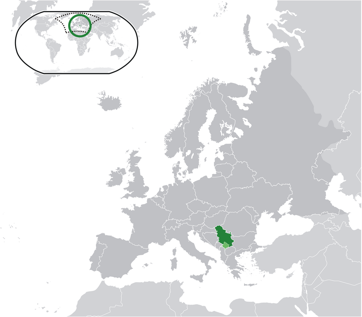
English: Location map: Serbia (dark green) / Kosovo (light green) / Europe (all green & dark grey); inspired by and consistent with general country locator maps by User:Vardion, et al |
| ތާރީހް | |
| މަސްދަރު | Own work |
| Author | Bosonic dressing |
| ހުއްދަ (Reusing this file) |
No |
Licensing
| I, the copyright holder of this work, release this work into the public domain. This applies worldwide. In some countries this may not be legally possible; if so: I grant anyone the right to use this work for any purpose, without any conditions, unless such conditions are required by law. |
ޞަފްޙާގެ ތާރީޚް
Click on a date/time to view the file as it appeared at that time.
.png&dir=prev)
.png&offset=20090616034028)
.png&offset=&limit=20)
.png&offset=&limit=50)
.png&offset=&limit=100)
.png&offset=&limit=250)
.png&offset=&limit=500)
| ތާރީޚް/ގަޑި | ތަމްބްނެއިލް | Dimensions | މެމްބަރު | ޚިޔާލު | |
|---|---|---|---|---|---|
| މިހާރު | 13:28, 17 ޖޫން 2009 | | 2,056 × 1,800 (367 KB) | Bosonic dressing | Serbia (dark green) / Kosovo (light green) / Europe (all green & dark grey); inspired by and consistent with general country locator maps by User:Vardion, et al - updated (!) - wider scope (fix UK, Faeroes) |
| 13:26, 17 ޖޫން 2009 |  | 2,056 × 1,800 (366 KB) | Bosonic dressing | Serbia (dark green) / Kosovo (light green) / Europe (all green & dark grey); inspired by and consistent with general country locator maps by User:Vardion, et al - updated (!) - wider scope (fix UK, Faeroes) | |
| 10:59, 17 ޖޫން 2009 |  | 2,056 × 1,800 (366 KB) | Bosonic dressing | Serbia (dark green) / Kosovo (light green) / Europe (all green & dark grey); inspired by and consistent with general country locator maps by User:Vardion, et al - updated (!) - wider scope (fix UK, Faeroes) | |
| 14:45, 16 ޖޫން 2009 |  | 2,056 × 1,800 (366 KB) | Bosonic dressing | Serbia (dark green) / Kosovo (light green) / Europe (all green & dark grey); inspired by and consistent with general country locator maps by User:Vardion, et al - updated (!) - wider scope (fix UK) | |
| 14:09, 16 ޖޫން 2009 |  | 2,056 × 1,800 (367 KB) | Bosonic dressing | Serbia (dark green) / Kosovo (light green) / Europe (all green & dark grey); inspired by and consistent with general country locator maps by User:Vardion, et al - updated (!) - wider scope | |
| 13:20, 16 ޖޫން 2009 |  | 2,056 × 1,800 (368 KB) | Bosonic dressing | Serbia (dark green) / Kosovo (light green) / Europe (all green & dark grey); inspired by and consistent with general country locator maps by User:Vardion, et al - updated (!) - wider scope | |
| 11:35, 16 ޖޫން 2009 |  | 2,056 × 1,731 (365 KB) | Bosonic dressing | Serbia (dark green) / Kosovo (light green) / Europe (all green & dark grey); inspired by and consistent with general country locator maps by User:Vardion, et al - updated (!) | |
| 09:19, 16 ޖޫން 2009 |  | 2,056 × 1,731 (365 KB) | Bosonic dressing | Serbia (dark green) / Kosovo (light green) / Europe (all green & dark grey); inspired by and consistent with general country locator maps by User:Vardion, et al - updated | |
| 08:42, 16 ޖޫން 2009 |  | 2,056 × 1,731 (341 KB) | Bosonic dressing | Serbia (dark green) / Kosovo (light green) / Europe (all green & dark grey); inspired by and consistent with general country locator maps by User:Vardion, et al - updated | |
| 08:40, 16 ޖޫން 2009 |  | 2,056 × 1,727 (343 KB) | Bosonic dressing | Serbia (dark green) / Kosovo (light green) / Europe (all green & dark grey); inspired by and consistent with general country locator maps by User:Vardion, et al - updated |
ފާލަންތައް
The following page uses this file:
Global file usage
The following other wikis use this file:
- Usage on ami.wikipedia.org
- Usage on ar.wikipedia.org
- Usage on azb.wikipedia.org
- Usage on bh.wikipedia.org
- Usage on bo.wikipedia.org
- Usage on bs.wikipedia.org
- Usage on ch.wikipedia.org
- Usage on cs.wikiquote.org
- Usage on da.wikipedia.org
- Usage on de.wikipedia.org
- Usage on ee.wikipedia.org
- Usage on el.wikipedia.org
- Usage on en.wikipedia.org
- Usage on en.wiktionary.org
- Usage on eo.wikipedia.org
- Usage on fa.wikipedia.org
- Usage on ff.wikipedia.org
- Usage on gag.wikipedia.org
- Usage on hr.wikipedia.org
- Usage on hr.wikiquote.org
- Usage on ig.wikipedia.org
- Usage on incubator.wikimedia.org
- Usage on koi.wikipedia.org
- Usage on krc.wikipedia.org
- Usage on lfn.wikipedia.org
- Usage on ltg.wikipedia.org
- Usage on lt.wiktionary.org
- Usage on lv.wikipedia.org
- Usage on mi.wikipedia.org
- Usage on mzn.wikipedia.org
- Usage on nn.wikipedia.org
- Usage on oc.wiktionary.org
View more global usage of this file.
.png)
.png)